On Thursday, March 1st : 7pm to 8pm, a second community meeting will take place for a proposed residential development located at 1515 W. Monroe St. The site is also known as the former location of the Salvation Army Freedom Center. The meeting will be hosted by Alderman Jason Ervin and will take place at the Park Tavern Banquet Room (1645 W. Jackson Blvd). The following post serves as a recap of the first community meeting that took place on January 30th at Park Tavern and as a guide for residents in advance of the upcoming meeting.
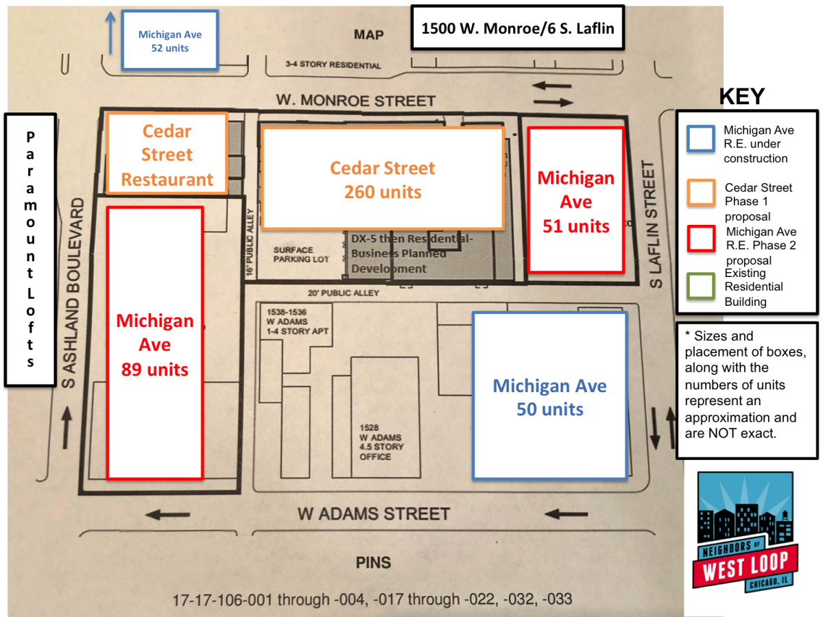
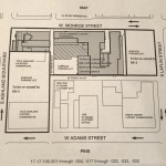
The developers, Cedar Street., purchased the property ( Salvation Army Freedom Center Complex- 1515 W. Monroe ) in 2015 and have recently applied to Ald. Ervin for a zoning change from the City of Chicago. The property is approximately 3.18 acres encompassing almost an entire city block (Ashland, Monroe, Laflin & Adams) and represents one of the largest redevelopments in the Western section of the West Loop. See the diagram below for the boundaries of the redevelopment.
You can read about the first presentation to the NOWL development committee on November 13, 2017 here, and see the first communication received by residents residing within 250 feet of the property immediately below. The letter and map were sent from their zoning attorney, DLA Piper, and include details about the specific zoning changes being requested.
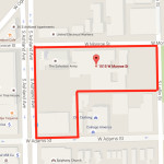
- Google Map image used in Curbed Chicago article on May 28, 2015 that roughly outlines the property purchased by Cedar Street in 2015.
- Letter send to residents within 250 feet of the property from DLA Piper, representing the developers.
- A map of the development site printed on the reverse side of the DLA Piper letter sent on October 5, 2017.
The first community meeting took place on January 30th with well over one hundred West Loop residents in attendance.
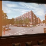
- First images shown to residents on January 30th of the proposed Michigan Avenue Real Estate development at the corner of Laflin and Monroe (currently a parking lot.)
- Approximately 125 residents came out to the first community meeting on the requested zoning changes to the property site located between Laflin and Ashland south of Monroe.
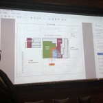
- Overview of what Cedar Street referred to as Phase 1 in their presentation to community members on January 30th.
Mark Heffron of Cedar Street led the meeting. He opened his presentation by highlighting the three points that he believed reflected the feedback he had received from the Alderman and the residents of the community to this point, which were:
- Acknowledging a lack of detail attached to their Phase 2 of the proposed development.
- Managing how much density is added to the neighborhood and Cedar Street’s building height with respect to the residents of Paramount Lofts, located at 1645 Ogden.
- The impact of Cedar Street’s development on neighborhood density and in turn on the traffic and accessibility to parking for existing residents.
In addition to these points, there have been additional concerns that have been raised by residents that were not mentioned by Mr. Heffron, including:
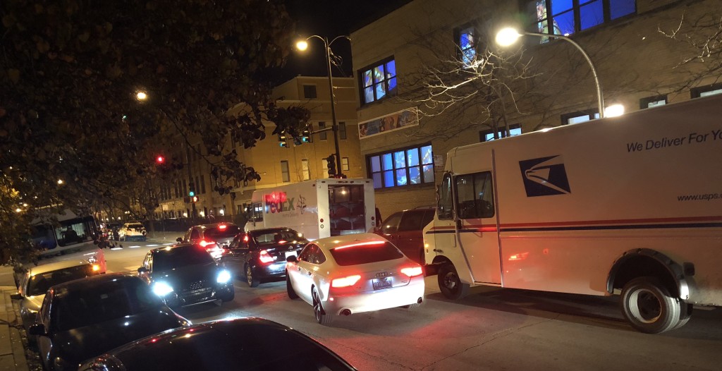
Three shipping trucks clog Monroe St. just east of Racine on December 1, 2017. (PHOTO: Brian Ferber)
- Need for a clearly defined a plan for loading and unloading of passengers, moving trucks, and service vehicles for tenants of both the residential and retail units (Coffee shop, gym, etc.) Monroe St. already becomes a hazard (see picture above) at numerous points with zero residents living on the south side of Monroe St. east of Ashland Ave.
- Need for a dedicated off-street driveway by the main entrance of the residential building for drop off and pick up for shared ride and taxis.
- Make green space public to provide a community benefit
- Create a public dog run for smaller dogs (a compliment to the Skinner Bark Park located at 1450 W. Monroe.) There is a problem with dog waste along the sidewalks of Monroe St already.
- Unlike other developments being approved in the West Loop, there is no community benefit attached to this development. i.e., donation of land for public green space and/or a formal agreement to grant public access to green space to be located at Monroe and Laflin.
- Concerns were raised about the noise level from events that the developer plans in the green space (Yard ) located behind the 1515 W. Monroe St. building along the alley.
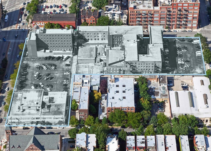
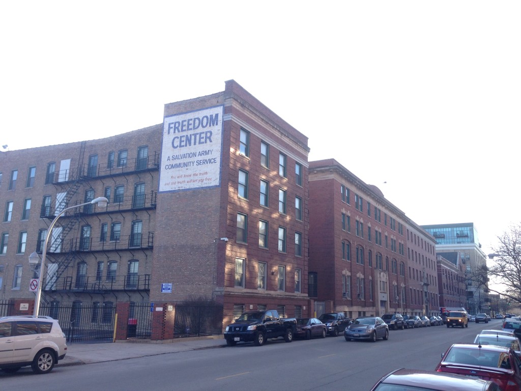
The image from Colliers International brochure and used in the Curbed Chicago article by AJ LaTrace published on May 28, 2015.
1. Lack of detail attached to Phase 2 of the proposed development
Mr. Heffron acknowledged the lack of detail attached to Cedar Street’s original proposal, specifically in the Phase 2 portion, which comprises:
- The parking lots located on Ashland Ave
- The parking lots located at Laflin and Monroe
- The 2-story building on the corner of Adams and Ashland
Mr. Heffron explained that a number of options were explored for Phase 2, including a potential high-rise building along Ashland and/or a retail component/grocery store.
After exploring all of these options, Cedar Street decided to partner with Michigan Avenue Real Estate Group to build on the areas outlined as Phase 2 in the original proposal. See below for details shared in the Michigan Avenue R.E. plan.
2. Managing how much density is added
PROJECT A – DUNCAN -Y Flats ( Cedar St.) – originally Phase 1
The Salvation Army relocated the Freedom Center to West Humbolt Park in 2014. During it’s operations in the West Loop center, it housed between 150 and 200 residents, who lived under significant restrictions, including in most cases the inability to own and operate a vehicle. There was an operating staff of approximately 30 people for the Salvation Army on any given day.
The site is currently zoned for institutional use as a Planned Development with a 3.0 FAR (PD #773). Cedar Street is seeking an up-zoning to DX-5 (4.0 FAR) and a re-zoning to DX-3. In addition, the two smaller buildings on Ashland (& Monroe) have been landmarked.
One of the Ashland buildings, originally built as a YMCA, will be renovated into a full-service gym for their tenants to utilize as an amenity. Cedar Street also plans to make gym memberships available for purchase to non-residents of their development.
The larger building located at 1515 W. Monroe does NOT currently have landmark status. The developer has applied for landmark status as part of this redevelopment. These three buildings would comprise Cedar Street’s portion of the redevelopment and be named Duncan-Y, as a nod towards the old YMCA that used to operate in one of the smaller buildings on Ashland.
The surface parking lot along the two alleys will be turned into a “Yard” with green space for their tenants. Cedar Street plans to also hold outdoor events in the “Yard” which will be open to the public during these events.
The Skinner Park Advisory Council (SPAC) have requested that the green space be made public and moved to the corner of Laflin and Monroe to serve as a pocket park to the community. SPAC’s recommendation includes a dog park dedicated for small dogs to compliment the larger Skinner Bark Park dog park, located at Loomis and Monroe.
This green space would provide a welcome space for residents at times when Skinner Park is heavily used by both of the schools (Skinner West and Whitney Young) and the Chicago Park District. As a frame of reference, the West Loop is short by over 34 acres in park land to serve the current number of West Loop residents, as determined by the City of Chicago standards.
The developer also plans to feature a Heritage Bikes Coffee shop as a tenant in the lobby of the 1515 W. Monroe building by the main entrance. The coffee shop would be open to the general public.
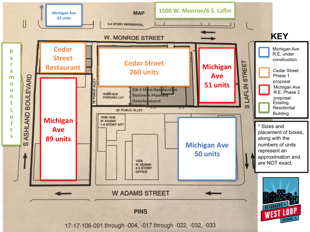
The information contained in this graphic on information that the public has received up to February 28, 2018. Sizes and placement of the boxes on the map, along with the numbers of units represent an approximation and are NOT exact.
The majority of the residential units would be at the 1515 W. Monroe building. The Duncan-Y – Flats (Cedar Street) would be developed as a planned development. Harlem-Irving Development is a partner with Cedar Street in the development.
Mr. Heffron explained that Cedar Street’s original breakdown of units would be approximately the same as the original numbers presented (260-288 total units) on November 13, 2017:
- Between 130 and 144 half studios (331 sq ft)
- Between 130 and 144 half convertible/one-bedroom (443 sq ft for convertibles and 502 sq ft for one-bedroom units
Project B Michigan Avenue Real Estate…originally Phase 2
Thomas Meador, President & CEO of Michigan Avenue Real Estate Group and his team spoke to their proposal for a portion of this development. Michigan Avenue R.E. has developed and owns over ten apartment buildings in the West Loop in recent years. Their developments are 4-story buildings with mostly 2-bedroom apartments. All Michigan Ave R.E. apartments provide 1 to 1 parking.
The areas that Michigan Avenue R.E. would develop comprises:
- The parking lots located on Ashland Ave
- The parking lots located at Laflin and Monroe
- The 2-story building on the corner of Adams and Ashland
These areas would be taken out of the existing plan development and rezoned. None of the Michigan Avenue R.E. buildings would be part of the Cedar Street plan development. Michigan Ave would simply be purchasing the land and redeveloping it as a separate project.
Mr. Meador provided the following breakdown for the three buildings that would be constructed in the Project B (Originally Phase 2) area:
- Ashland – 113 S. Ashland (2 buildings with 89 total units)
- (2) 3-BR units (appx 1,450 sq ft)
- (81) 2-BR units (appx 1,050 sq ft)
- (6) 1-BR units (appx 750 sq ft)
- Laflin – 1501 W. Monroe (1 building with 51 units)
- (7) 3-BR units (appx 1,450 sq ft)
- (44) 2-BR units (appx 1,050 sq ft)
While not part of this proposal, Michigan Avenue R.E. is already in the process of building an apartment building on the old Tramco Pump property, which is located at the corner of Adams and Laflin.
Mr. Heffron explained that when combined with the Michigan Avenue R.E. units, approximately 30% of the overall units would be studio apartments and that the average unit size overall would be approximately 650 sq ft. There is very little change to the original Phase 1 proposal.
Alderman Ervin did make a point to mention that the downtown redistricting did extend to Ashland, meaning that the developers could apply for additional up-zoning and pay into the Neighborhood Opportunity Bonus. However, this project will not generate any Neighborhood Opportunity Bonus.
3. Impact of density on the traffic and accessibility to parking for existing residents
This subject contains two elements, which run counter to each other to some extent: Parking and Traffic/Congestion.
Parking
Cedar Street’s original proposal included no parking. Mr. Heffron cited 1) proximity to public transportation, 2) that their property was landmark and was not required to have parking and 3) his assertion that their tenants do not have cars as the reasoning behind not providing parking. This was not received well be the residents in attendance at the original meeting, as parking is already at a premium. However, Neighbors of West Loop determined that only the two small historic buildings on Ashland were landmarked. By law, the largest building at 1515 W. Monroe is not a landmark and have no waiver on parking needs. Alderman Erivn did confirm that he put Cedar St. Landmarking request on hold until the parking issue was resolved.
By including Project B ( originally Phase 2) with Michigan Avenue R.E. which will now be developed as a separate venture, Mr. Heffron pointed out that 164 parking spots would be offered in their updated combined proposal for up-zoning and re-zoning. Cedar Street was able to increase the “overall” parking offered by including the three buildings that Michigan Avenue R.E. would build, which does include 1:1 parking for their units. Michigan Ave would build 23 additional outdoor parking spaces along the East West alley between Adams and Monroe which could be rented to tenants of Cedar St. “Flats”. However Cedar St. would not own these parking spots, they would be owned by Michigan Ave. R.E.
Overall, residents were not happy with this “transfer” of parking ratio concept in an effort to inflate the parking ratio for the Cedar St. part of the development.
Parking Ratios:
- Project A ( Original Phase 1 ) Cedar Street’s Duncan-Y – Flats: 260 units with 23 parking spaces available for lease from Michigan Avenue R.E. Cedar Street will still not have any on-site parking.
- Project B ( Original Phase 2) Michigan Avenue Real Estate Group: 140 units with 140 parking spaces.
Traffic/Congestion
Mr. Heffron introduced a representative from Kenig, Lindgren, O’hara, Aboona, Inc. (KLOA), who is currently conducting a traffic study. As of January 30, the traffic study was still in progress, however the following details were shared:
The methodology of the study was run on eight intersections surrounding the proposed development at 1515 W. Monroe and was conducted during an evening when the Chicago Bulls were playing a game at the United Center in December, 2017. The KLOA rep said that, “The addition of these three buildings will not add much to the current street system.” When questioned about the methodology and lack of definitive results to share, he noted that they have not completed the traffic study at that time.
He added these pieces of anecdotal information:
- Fifty percent (50%) of current West Loop residents do not drive to work
- Millennials don’t own cars.
In order to better understand the anticipated traffic demand, a comprehensive and impartial traffic study should be conducted and shared with residents that includes recommendations for traffic control and improvements at all intersections on Monroe St. and Ashland Ave. adjacent to the property.
One resident in attendance at the Jan 30th community meeting asked Alderman Ervin if Neighbors of West Loop or some other independent agency could conduct a traffic study that would be seen as impartial and beneficial to the residents who live in his ward. Alderman Ervin responded by saying he would be open to looking at other options provided he was not responsible for funding such an initiative.
Cedar Street and Michigan Avenue Real Estate teams will present an undated presentation on Thursday, March 1st. We hope to see West Loop residents at the meeting. We plan to follow up with our official positions. At the end of the day, this is a great opportunity for the neighborhood to take a step forward and not backward for the residents of our community.
Date: February 27, 2017
By: NoWL Development Committee, Brian Ferber and May Toy
Related Links
- NoWL Development Committee Initial Feedback (11/19/17)
- WHP Development Council (3/13/14): Salvation Army Brings the Freedom Center to West Humboldt Park
- Curbed (5/28/15): West Loop Salvation Army Complex for Sale
- Crain’s (9/9/15): Apartments Coming to Salvation Army Site on West Side
- DNAinfo (9/16/15): Apartments Planned for Former Salvation Army Site on Near West Side

